June 14, 2013
It's hard to imagine coming from the Canadian Rockies to South Africa to go hiking in the mountains. But that is precisely what we did, and it lived up to, and far exceeded, every expectation we had.
Drakensburg means "Dragon's Mountains" in Afrikaans, and the Zulu name for the mountain range is Quathlama, which translates to "Battlement of Spears"; the locals simply call it "the Berg". This mountain range is located on the eastern border of Lesotho and South Africa, with the northern part of the range sitting approximately 300km from Johannesburg, making it a popular weekend destination. There are several national parks that make up the Drakensburg mountain range; we visited only the northern-most section (finishing in the Royal Natal National Park). The main goal being to reach the Ampitheatre: a sheer wall of rock with nearly perfect symmetry extending over 5km in length from the Eastern Butress to Sentinel Peak in the west. The wall rises up over 1000m from the valley below, and is nearly 3000m above sea level. Our trip included three day-long hikes, that were strung together to allow us to see a huge amount of the area, covering over 40km on foot in our three days.
Given the stunning beauty of this place, here is a bit of a photo-essay of our trip (photos are courtesy of yours truly, M, S, G, our guides, and my gorilla tripod):
DAY 1
Distance: 13.64km, Elevation gain: 984m

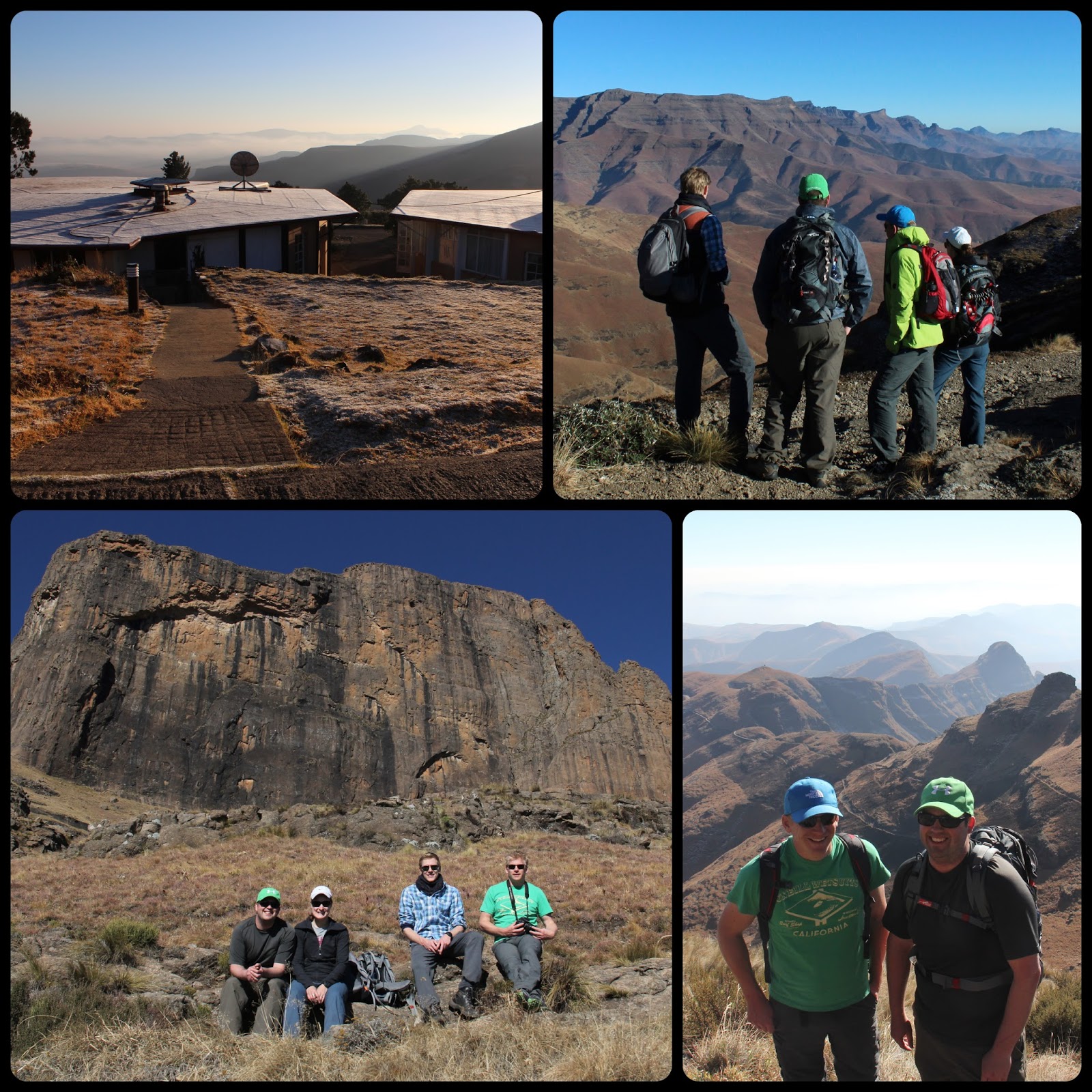
Starting out from Ledges Guest Farm (bottom photo: cliffs on the drive in the night before the hike).

Reaching the top of Sugar Loaf Gap, above the Sandstone Cliffs; taking a break to capture the view.

Cold Ridge: walking along the border of two provinces, with KwaZulu Natal on one side and the Free State on the other.

Last leg of today's hike, passing Broome Hill to reach the Basotho Gate and Witsieshoek Mountain Resort, where we spent the next two nights (seen in bottom left photo); thanks Chellock and your son for making sure we made it safely to Witsies! Also, yes, that is snow in South Africa!

How we spent our evenings at Witsies: putting our feet up, reviewing the day's photos, drinking a few well deserved beers, and playing Settlers by the fire.
DAY 2
Distance: 13.39km, Elevation gain: 1021m
Waking up on Day 2 with a frosty coating and ready to take on the Ampitheatre! Taking a rest under Sentinel Peak and looking out over the Malutis and Witsiehoek plateaux.

Tackling the chain ladders up the 30m rock wall (not for the faint of heart!).

View from the top of the ladders, before heading across the escarpment to the Ampitheatre.

The famous Ampitheatre views. Thanks Samson for making this day a true highlight for all of us!
DAY 3
Distance: 13.02km, Elevation loss: 757m

Weaving down the mountain through the Mahai River valley.

Random cliff-side rocks make for good jumping photos...

The only day without a guide, we relied on GPS and a very cryptic map to make our way down the mountain. We made it! A very well deserved round of milkshakes and pizzas before heading back to Joburg completed our incredible weekend!
What an incredible journey!
ReplyDeleteThe scenery is breath- taking - so barren, yet beautiful.
Love the photo of you guys doing the jump. Had to plan that picture. :0
Was it very quiet there or constant noise from wind?
Certainly a place to feel alone and small.